Oil and Gas
Upstream, Midstream, and Downstream
Upstream, midstream, and downstream sectors of the oil and gas industry location intelligence solution set
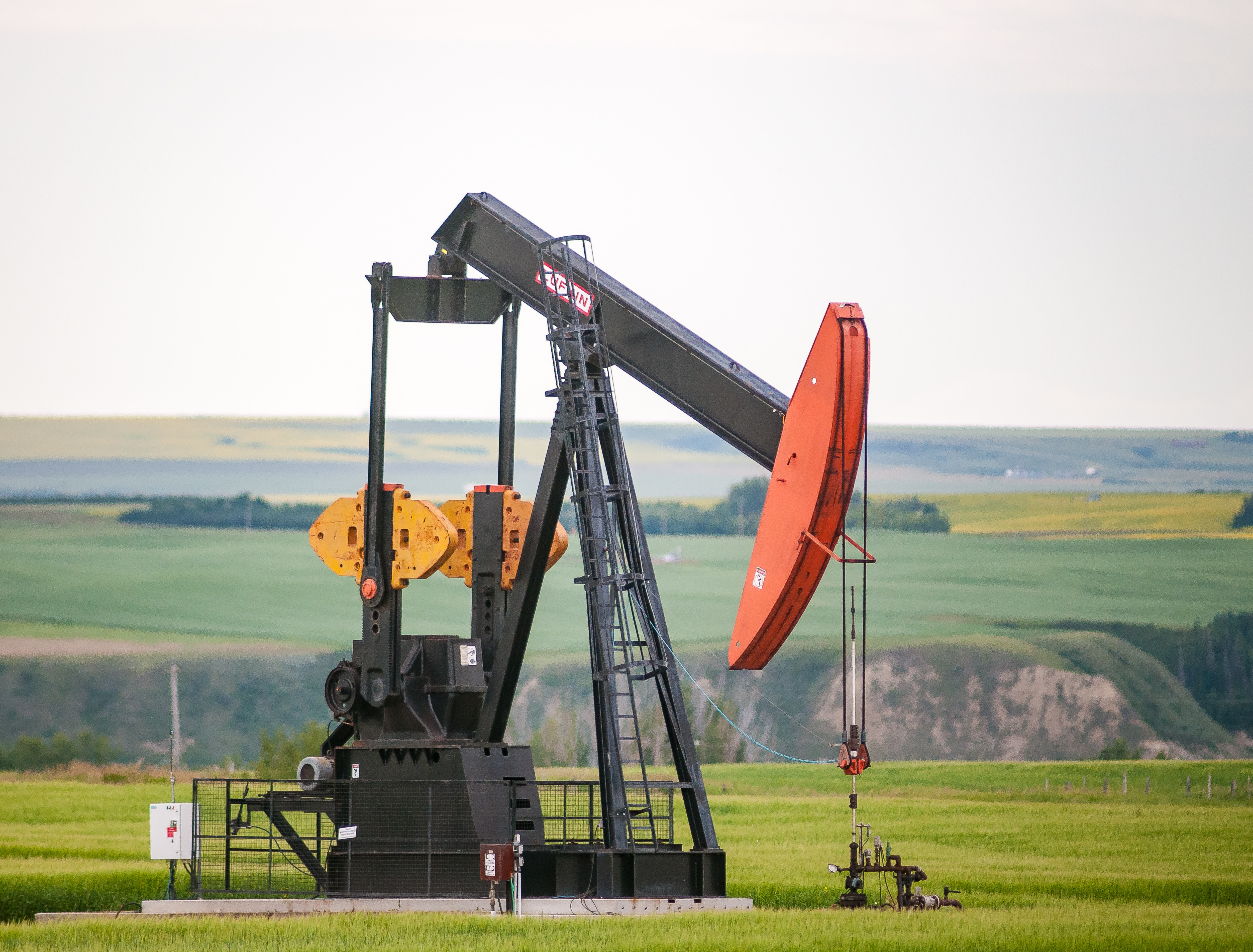
Upstream, midstream, and downstream sectors of the oil and gas industry utilize location intelligence data in various ways to improve operations, safety, and decision-making. LightBox SmartFabric is a critical component of Geographic Information Systems (GIS) operations and helps these sectors manage their assets and infrastructure effectively.
Upstream:
- Lease Acquisition and Management: SmartFabric data is crucial for identifying and acquiring leases for drilling operations.
- Well Site Selection: Property data assists in the selection of well sites. Upstream companies analyze property data to determine the most suitable locations for drilling based on factors like Land ownership, accessibility, and environmental impact.
- Risk Assessment: SmartFabric is used to assess various risks, including legal, environmental, and community-related risks that may affect upstream operations.
- Land Access negotiations: Upstream companies rely on SmartFabric data as a source to negotiate land access agreements with landowners or regulatory authorities.
Midstream:
- Pipeline Routing and Planning: SmartFabric is essential for selecting the optimal routes for pipelines.
- Facility Siting and Design: SmartFabric can be sued to determine the best locations for storage facilities, compressor stations, pump stations and other midstream infrastructure.
- Land use and Environmental Impact Assessment: SmartFabrics' parcel and assessment data aids in conducting land use and environmental impact assessments for midstream products.
- Emergency Response Planning: Property data is crucial for emergency response planning.
- Asset Portfolio Management: Your company has an asset portfolio and those assets need to be managed. SmartFabric is a critical ingredient for these activities when tracking ownership.
Downstream:
- Refinery Site Selection and Design: SmartFabric data is crucial for selecting and designing refinery locations.
- Facility Siting: SmartFabric can be used to determine the best locations for storage tanks, blending facilities and distribution terminals.
- Retail Site Selection: Downstream companies use SmartFabric data to select retail outlet locations.
- Real Estate Management: use SmartFabric to manage your real estate assets including office buildings, administrative facilities, and employee housing associated with downstream operations.
SmartFabricSM
A robust address universe, with the highest locational accuracy, linked to rich attribution, to solve your business needs.
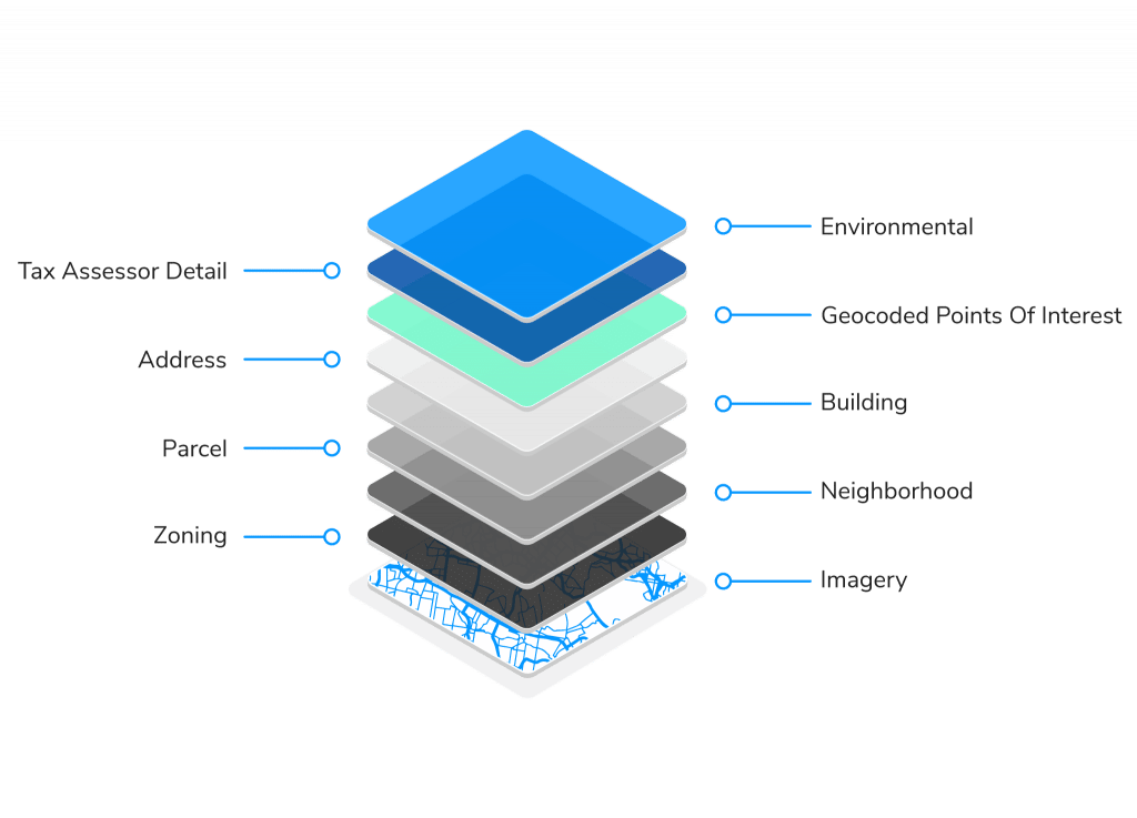
- Access to the most reliable location and property data including parcels, structure footprints, addresses, tax and deed data, zoning information, residential and business usage, and more.
- Built on a consistent data model for straightforward data onboarding and integration.
- LightBox uses over 5000 data sources to continuously deliver high-accuracy data for all 50 states, Washington D.C, and U.S. territories.
- Solves for needs that require a high level of fidelity and location accuracy over a large area, including rural regions.
- Largest nationwide collection of parcel boundaries and structure footprints, as well as secondary addresses for both residences and businesses.
APIs built for Oil and Gas workflows
LightBox's experience helps you create workflows to analyze data and bridge the Digital Divide.
- A powerful geocoder and apn lookup tools to locate and link property assets.
- National parcel fabric with ownership, zoning, land use that can be used through LightBox APIs.
- Link your assets through LightBox APIs and the LightBox persistent identifier.
- Relationships from address to parcel, parcel to assessment, assessment to structures is built into our API endpoints
Benefits of using LightBox APIs within your workflows
Secure, lightweight, powerful APIs that are available 24/7.
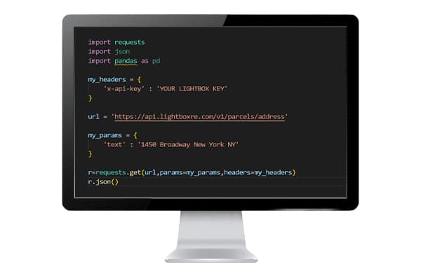
- Access to the SmartFabric universe through easy-to-implement RESTful APIs.
- Free up your data team to optimize their time and let LightBox do the heavy data processing, normalization, and management of core datasets.
- Relationships between addresses, parcels, assessment and other layers is built into the LightBox APIs using the LightBox IDs.
- Continuous access to the most current data available.
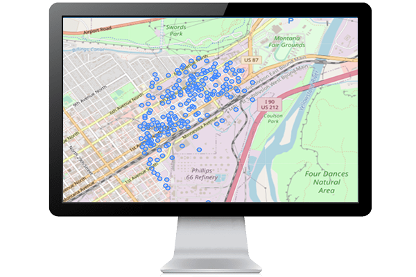
- Add SmartFabric data to your mapping applications.
APIs included within the SmartFabric Oil and Gas Solution
Access to the LightBox core APIs to support your upstream, midstream, and downstream needs.
Geocoder API
- The LightBox Geocoder enables connections from an address to the SmartFabric record.
- The geocoder identifies how well it matched to the input address with a multi-factor confidence score, allowing your application to be confident in the address it returned.
- Not only will the LightBox Geocoder return the coordinates, it also returns a precision code that identifies how accurate the location is (rooftop, parcel centroid, etc.)
- Connectivity is built into the LightBox Geocoder. Each response will include LightBox IDs that link back to parcels, assessment, structures, and location data.
- The autocomplete endpoint makes type-ahead easy for your end users.
- Reverse geocoding is supported. If you have a point location rather than an address, we will return one or more addresses that are closest to that point location.
- The response includes the parsed address components, along with the address, city, state, and country.
Parcels API
- API endpoints work with the SmartFabric Parcel layer.
- Access to the Parcel boundary and key parcel attributes.
- Understand the complete lot(s) with adjacent-ownership search.
- Identify a parcel using a geometry, address, or any one of the LightBox IDs.
- Add Parcel boundaries and interactivity to your mapping applications.
Assessments API
- API endpoints work with the SmartFabric Assessment layer.
- Access to ownership, address, building characteristics, zoning, lot size, sales information. and much more.
- Identify an assessor record using a geometry, address, or any one of the LightBox IDs.
- Add Assessment points and interactivity to your mapping applications.
Addresses API
- API endpoints work with the SmartFabric Address layer.
- Access the complete address universe that fuels the LightBox Geocoder.
- The ability to ask for all the addresses that are related to a Parcel, Structure, LocationInfo, or Assessment record.
- Understand if the address is a business or a residence, or if it is primary or a secondary address.
- Add address points and interactivity to your mapping applications.
- Connectivity is returned with LightBox IDs from the Parcel, Structure, Assessment, and LocationInfo records related to the returned address.
Structures API
- API endpoints work with the SmartFabric Structure layer.
- Return all structures that are on a parcel, assessment, or address using any one of the LightBox IDs.
- Return ground elevation, building height, square footage and the geometry that makes up the first-floor footprint.
- Add structure polygons and interactivity to your mapping applications.
Additional APIs that can be added to your subscription
Supporting APIs help to further realize the oil and gas potential.
Zoning API
- Gain a more complete picture of parcel data with deeper data from a single source.
- Provides zoning code, floor area ratio, setback requirements, building height, and more.
- Each zoning record returns a URL back to the municipality's ordinance.